- ES EXPONAV CARTAS NÁUTICAS CCN-000223
- Item
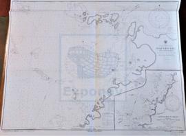
- 1936
Part of CARTAS NÁUTICAS
Zona Geográfica: Costa oeste de Italia. Mar Mediterráneo
Aparece la isla de Giglio, promontorio Argentario, ciudad de Civitavecchia y Fiumicino
INSTITUTO HIDROGRÁFICO ITALIA
324 results directly related Exclude narrower terms
Part of CARTAS NÁUTICAS
Zona Geográfica: Costa oeste de Italia. Mar Mediterráneo
Aparece la isla de Giglio, promontorio Argentario, ciudad de Civitavecchia y Fiumicino
INSTITUTO HIDROGRÁFICO ITALIA
Part of CARTAS NÁUTICAS
Zona Geográfica: Costa sur de Francia. Mar Mediterráneo
Aparece la ciudad de Marsella y el golfo de Fos.
Incluye un recuadro con el puerto de Bouc a escala 1:29160
INSTITUTO HIDROGRÁFICO FRANCIA
TORBJÖRNSKJAER TO RAÜO INCLUDING SINGLE AND IDE FJORDEN
Part of CARTAS NÁUTICAS
Zona Geográfica: Noruega y Suecia
Tierras de Suecia y Noruega.
Incluye dos recuadros a escala 1:25000 de Fredrikstad y Glommen to Sarpsborg
INSTITUTO HIDROFRÁFICO NORUEGA
Part of CARTAS NÁUTICAS
Zona Geográfica: Océano Atlántico Norte
Costas del sur de Estados Unidos de América, golfo de México, norte de Sudamérica e islas del mar Caribe.
INSTITUTO HIDROGRÁFICO INGLATERRA
HEBRIDES OR WESTERN ISLES FROM BARRA HEAD TO SCARPA ISLAND
Part of CARTAS NÁUTICAS
Zona Geográfica: Costa oeste de Escocia
Aparecen las tierras de Harris, Lewis, North Uist, Nenbecula y South Uist
INSTITUTO HIDROGRÁFICO INGLATERRA
Part of CARTAS NÁUTICAS
Zona Geográfica: Costa sur de Cuba. Indias Occidentales
Aparece la bahía de Niquero. Contiene un recuadro con las cercanías a Beliz incluyendo la bahía Guanito y el río Limones a escala 1:24321
INSTITUTO HIDROGRÁFICO ESTADOS UNIDOS DE AMÉRICA
NORTH ATLANTIC OCEAN. SOUTHWESTERN SHEET
Part of CARTAS NÁUTICAS
Zona Geográfica: Océano Atlántico
Aparece la costa este de Estados Unidos de América, mar del Caribe y la costa norte de Sudamérica
INSTITUTO HIDROGRÁFICO ESTADOS UNIDOS DE AMÉRICA
Part of CARTAS NÁUTICAS
Zona Geográfica: Costa norte de Cuba. Indias Occidentales
Aparece el puerto de Matanzas y el valle de Yumuri
INSTITUTO HIDROGRÁFICO ESTADOS UNIDOS DE AMÉRICA
PUERTO CABELLO TO RIO ORINOCO AND THE LESSER ANTILLES TRINIDAD TO MARTINIQUE
Part of CARTAS NÁUTICAS
Zona Geográfica: Venezuela. América del Sur
Aparece el mar del Caribe, Venezuela, islas Windward y las islas de Trinidad y Tobago.
INSTITUTO HIDROGRÁFICO ESTADOS UNIDOS DE AMÉRICA
LA GUAIRA TO PUNTA UNARE INCLUDING OFFSHORE ISLANDS
Part of CARTAS NÁUTICAS
Zona Geográfica: Venezuela. Mar del Caribe. Sudamérica
Aparece la costa de Venezuela, isla Tortuga, islas Los Roques y la isla Orchilla
INSTITUTO HIDROGRÁFICO ESTADOS UNIDOS DE AMÉRICA